Faroe Islands
Grass-roof villages, sea cliffs, and the lake that floats above the ocean.
Why Faroe Islands
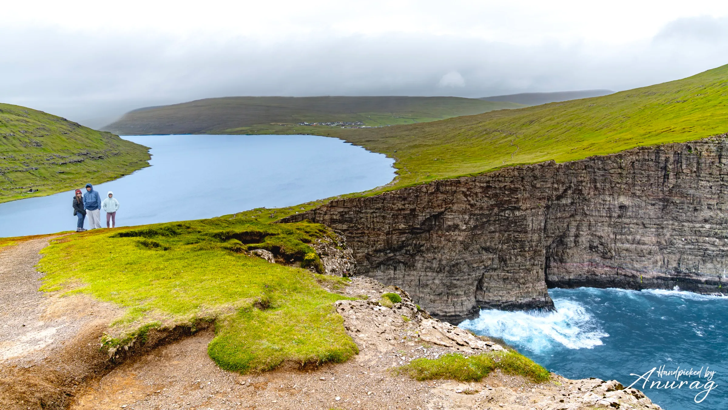
Eighteen green islands stitched together by tunnels, ferries, and sheep tracks. The Faroes are wild, wet, and quietly spectacular — the kind of place where a short walk ends at a cliff edge and a lake that looks like it's floating over the sea. We came for Leitisvatn and stayed for the fog.
The Faroe Islands are eighteen basalt islands adrift in the North Atlantic between Iceland and Norway — a self-governing nation within the Kingdom of Denmark, closer in spirit to the sea than to any continent. Sub-sea tunnels and small ferries stitch the archipelago together, so a road trip here is really an island-hop: one moment you’re in a grass-roofed hamlet, the next at a cliff edge where the Atlantic drops away and the fog rolls in sideways.
We come for the hikes that end at impossible views — a lake that hangs over the ocean, a waterfall that pours straight off the land, a lighthouse at the end of a knife-edge ridge — and for villages that have looked the same for centuries. The weather writes the itinerary, not you: pack for four seasons in an afternoon, rent something that handles gravel, and leave room to wait out a cloud. Half the Faroes’ magic is in the waiting.
Where it all is
Featured experiences
Hike
Lake Leitisvatn (Sørvágsvatn) — the lake above the ocean
The Faroes' most famous optical illusion — a large freshwater lake that appears to hang hundreds of metres above the crashing Atlantic. An easy-to-moderate walk along the shoreline leads to the Trælanípa cliff and the Bøsdalafossur waterfall.
moderate · 2–3 hours return · May–September
🎟 Book · GetYourGuide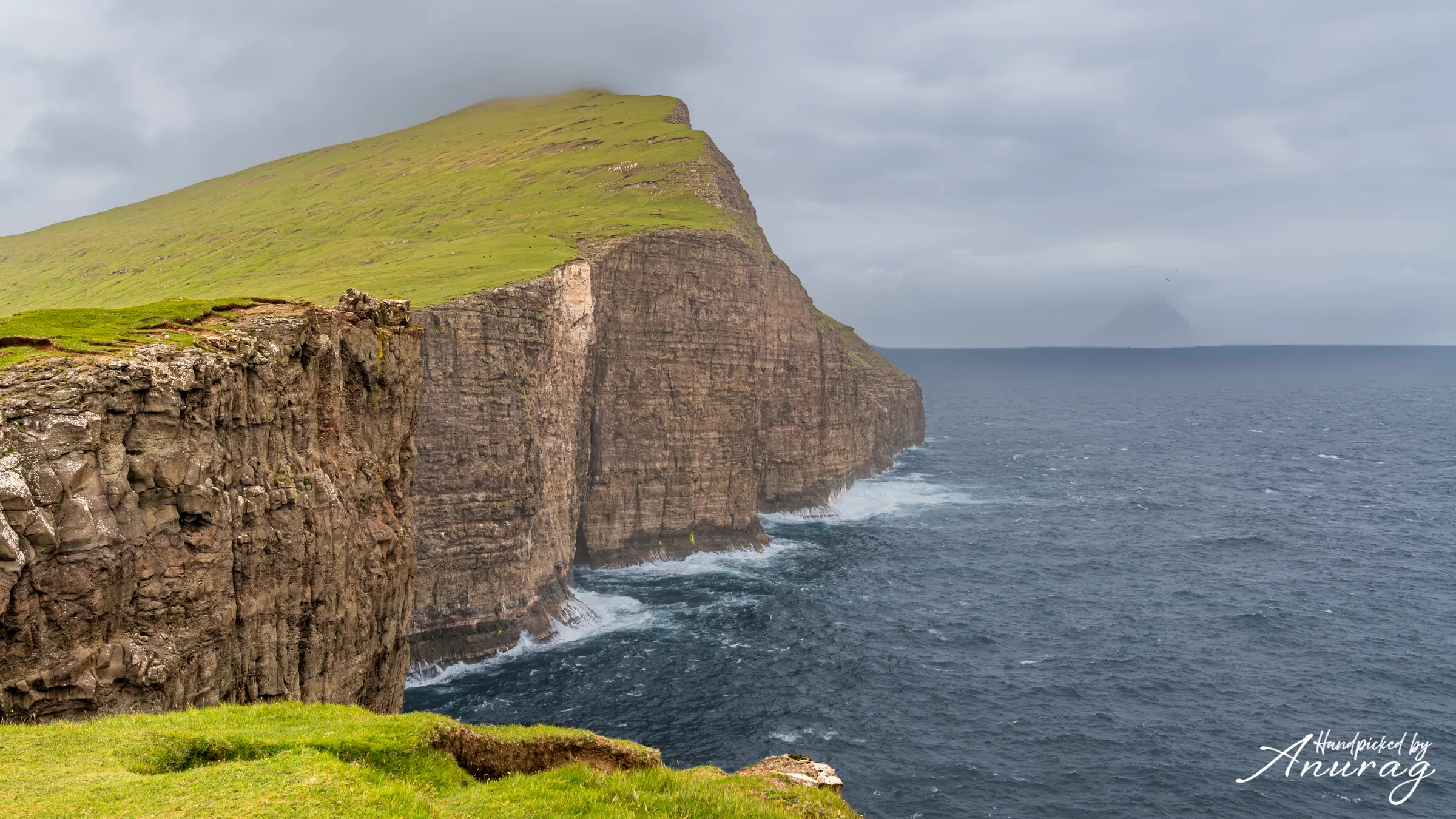
Viewpoint
Gásadalur & Múlafossur — the waterfall into the sea
The postcard of the Faroes: the tiny village of Gásadalur perched above Múlafossur, a waterfall that drops straight off the cliff into the Atlantic with jagged sea stacks behind. A short, near-flat walk from the car park to the classic viewpoint.
easy · 30–60 minutes · Year-round (best May–September)
🎟 Book · GetYourGuide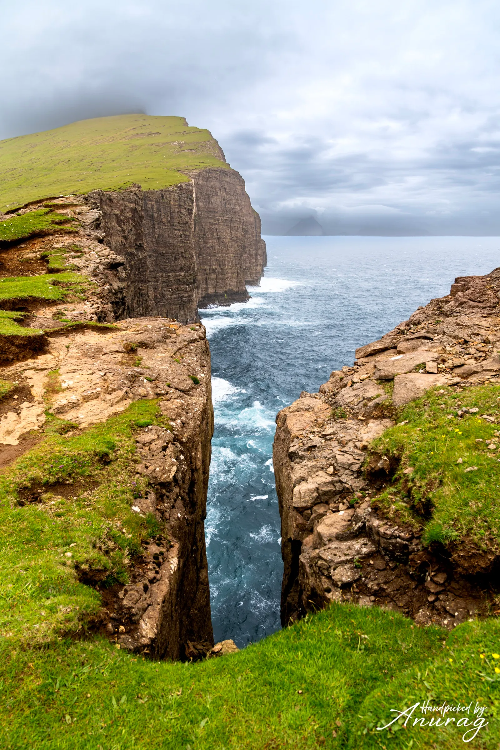
Island day-trip
Mykines — puffins, gannets & the far west
The westernmost island, a summer seabird city. A ferry (or short flight) reaches Mykines, then a guided cliff-top walk passes thousands of nesting puffins to the lighthouse and the gannet colony on Mykineshólmur.
moderate · Full day · May–August (puffin season)
🎟 Book · GetYourGuide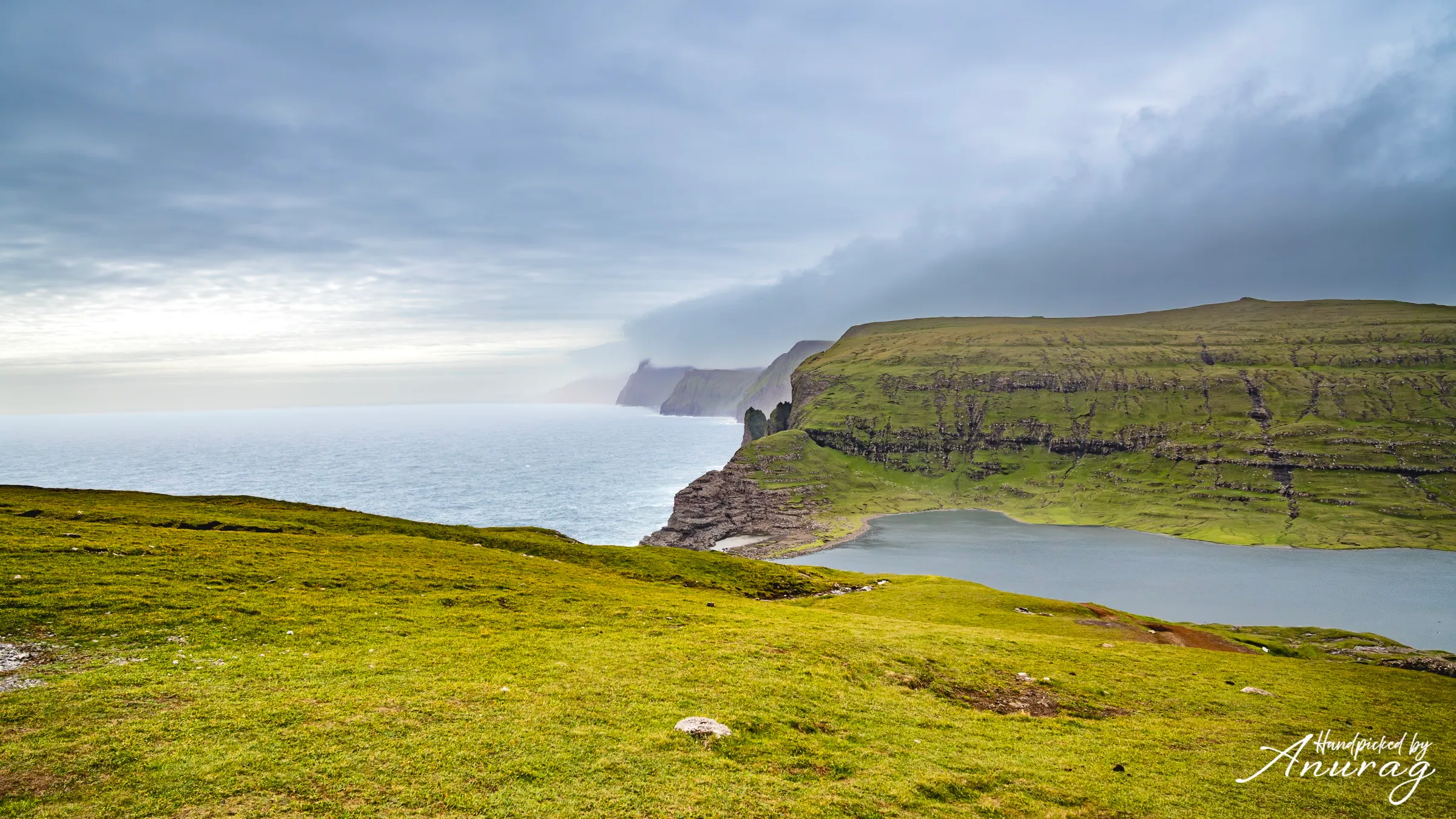
Village
Saksun — turf roofs & a hidden tidal lagoon
A handful of grass-roofed farmhouses at the head of a natural amphitheatre, above a tidal lagoon that empties to a black-sand beach at low tide. One of the most photographed — and most peaceful — corners of the islands.
easy · 1–2 hours · Year-round
🎟 Book · GetYourGuide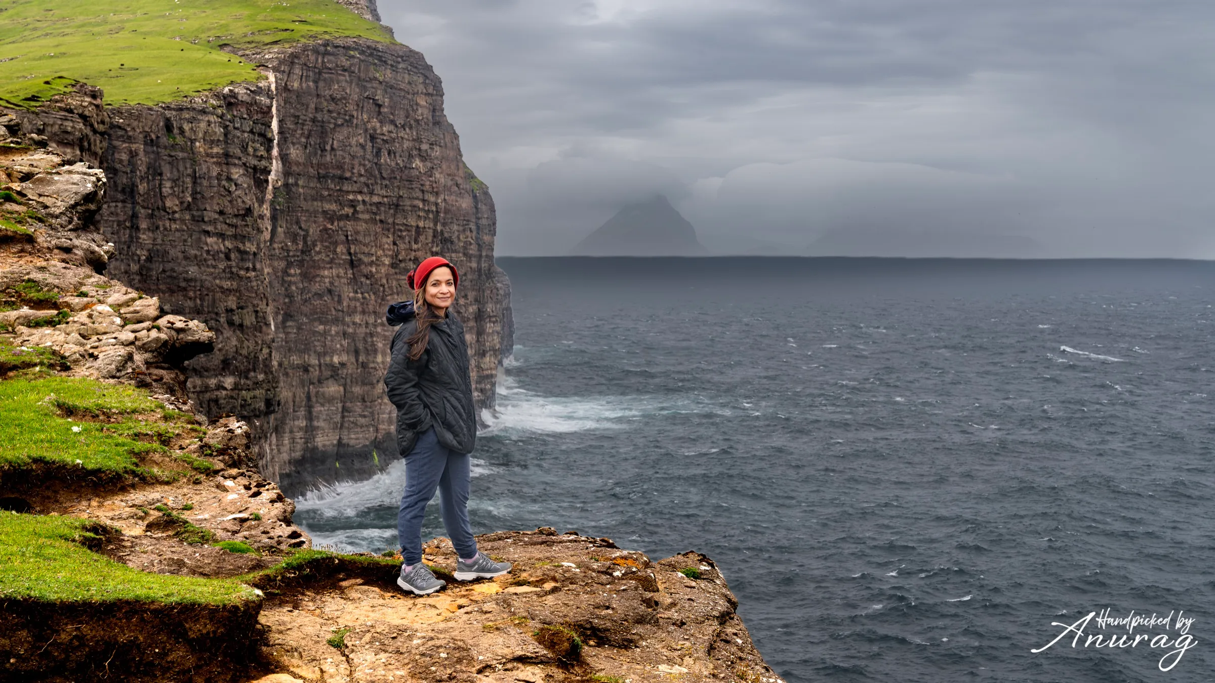
Hike
Kallur Lighthouse, Kalsoy — the knife-edge ridge
A dramatic ridge walk on the sliver-thin island of Kalsoy to a tiny lighthouse perched on a green promontory — the cinematic viewpoint made famous on screen. Requires a ferry, a drive through single-lane tunnels, and a head for exposure.
hard · 3–4 hours + ferry · June–September
🎟 Book · GetYourGuidePlanning resources
Best time to visit
May–September is prime: the mildest weather, the longest days (near-midnight light in June), and the seasonal ferries to Mykines and Kalsoy all running. July–August is busiest and best for puffins. Shoulder months (May, September) trade a little weather risk for fewer people. Winter is dramatic and quiet but many trails, tunnels-to-nowhere and ferries are weather-limited.
Driving & getting around
A rental car is the way to see the Faroes. Roads are excellent but narrow; expect single-lane tunnels with passing bays (learn the “M” bay rule) and the tolled sub-sea tunnels linking the main islands. Sheep have right of way — literally. Ferries and a couple of helicopter routes reach the outer islands; book the Mykines and Kalsoy ferries ahead in summer. Fuel up before heading to remote villages, and keep headlights on.
Weather & daylight
The Faroese say you get all four seasons in a day — and they’re right. Summers are cool (10–14°C), winters mild but wild; it’s windy and often wet year-round, with fog that rolls in fast on the cliffs. June brings ~19 hours of daylight; December barely 5. The upside of the changeability is extraordinary light. Build buffer days into any plan and treat the forecast as a rough suggestion, not a schedule.
What to pack
Layers, always. A genuinely waterproof jacket and trousers, waterproof hiking boots (trails are boggy), warm mid-layers even in July, gloves and a hat, and a dry bag for cameras. Wind can shred cheap umbrellas — skip them. Add a power bank, offline maps (signal drops in the tunnels and outer islands), and cash/card for the small landowner access fees at some trailheads (Leitisvatn, Saksun).
Drone rules
Drones are permitted in the Faroes under EU/EASA rules, but fly responsibly: keep clear of people, private farms, and — critically — nesting seabird colonies (Mykines is sensitive). Register as an operator if your drone requires it, respect no-fly zones near Vágar Airport, and always ask before flying over villages or private land. High wind is the practical limiter here more than regulation — pick your calm windows.
Suggested itineraries
Recommended stays
Streymoy, Faroe Islands
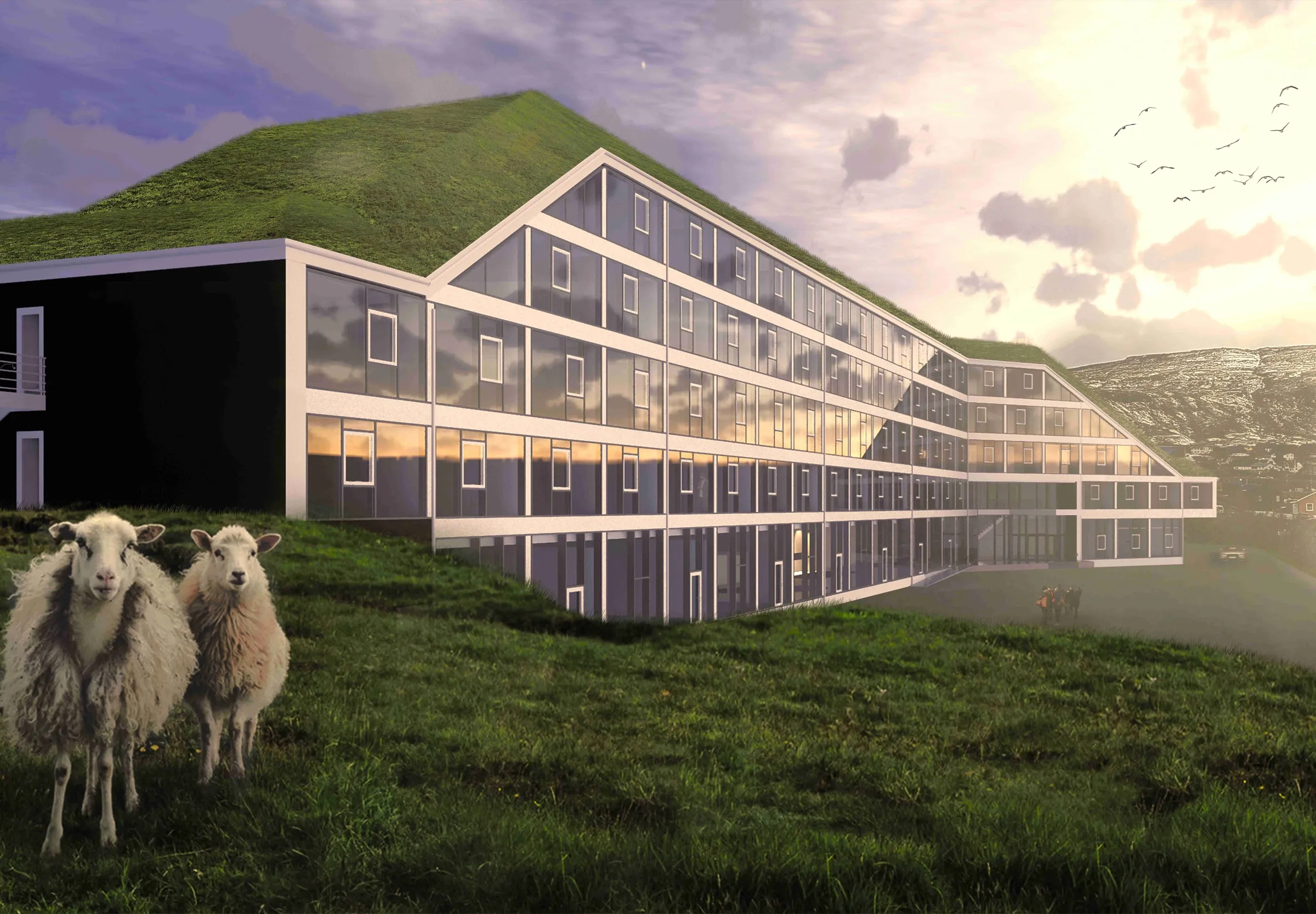
Hilton Garden Inn Faroe Islands
A calm, modern harbour in the heart of Tórshavn — full-service comfort with green-valley views, and the whole of the Faroes (cliffs, lakes and grass-roofed villages) within a day's drive.
Photography
Faroe Islands stories
Hiking to Lake Leitisvatn: The Optical Illusion That Left Me Speechless
Hiking to Sørvágsvatn (Lake Leitisvatn) on Vágar — the Faroe Islands' famous 'floating lake' illusion, the trail to Bøsdalafossur, and everything to pack, shoot, and know before you go.
Frequently asked
How many days do you need in the Faroe Islands?+
Five to seven days is the sweet spot. That’s enough to base yourself near Tórshavn, do the headline hikes (Leitisvatn, Gásadalur, Saksun), take a ferry day to Mykines or Kalsoy, and still leave buffer days to wait out the weather — which you will need.
How do you get to the Faroe Islands?+
Fly into Vágar Airport (FAE). Atlantic Airways and Scandinavian carriers connect it with Copenhagen, Reykjavík, Edinburgh and a handful of other European cities seasonally. There’s also a car ferry (Smyril Line) from Denmark via Iceland if you want to bring your own vehicle. From the airport, a rental car gets you almost everywhere via the tunnel network.
Are the Faroe Islands good for families with kids?+
Yes, with the right pacing. Short, high-reward walks (Gásadalur, Saksun) and the villages are wonderful for children, and Tórshavn is easy and safe. Save the exposed ridge hikes (Kallur Lighthouse) for older, sure-footed kids and calm weather — cliff edges are unfenced. Bring full rain gear for everyone and plan indoor fallbacks for the wettest days.
Are the Faroe Islands expensive?+
They’re on the pricier side, in line with Scandinavia. Accommodation, dining and fuel add up, and remote guesthouses book out in summer. You can soften it: self-cater some meals, mix a hotel in Tórshavn with a guesthouse or two, and remember most of the best experiences — the hikes and viewpoints — are free beyond the occasional small landowner access fee.
Do you need a car in the Faroe Islands?+
Effectively, yes — a rental car is the best way to reach the villages, trailheads and ferry ports on your own schedule. Public buses and ferries exist and are reliable between main hubs, but they’ll limit which viewpoints and hikes you can chain together. If you don’t drive, base in Tórshavn and use guided day tours for the outer islands.
Related destinations
Waterfalls, black sand, and the ring road — our most-travelled island.

Deep fjords, switchback roads, and the long northern blue hour.
More Faroe Islands, in your inbox
New destination guides, honest stays, and trip ideas — a few times a season, never spam.